

BEFORE
Gas Companies Expansion Development Plans
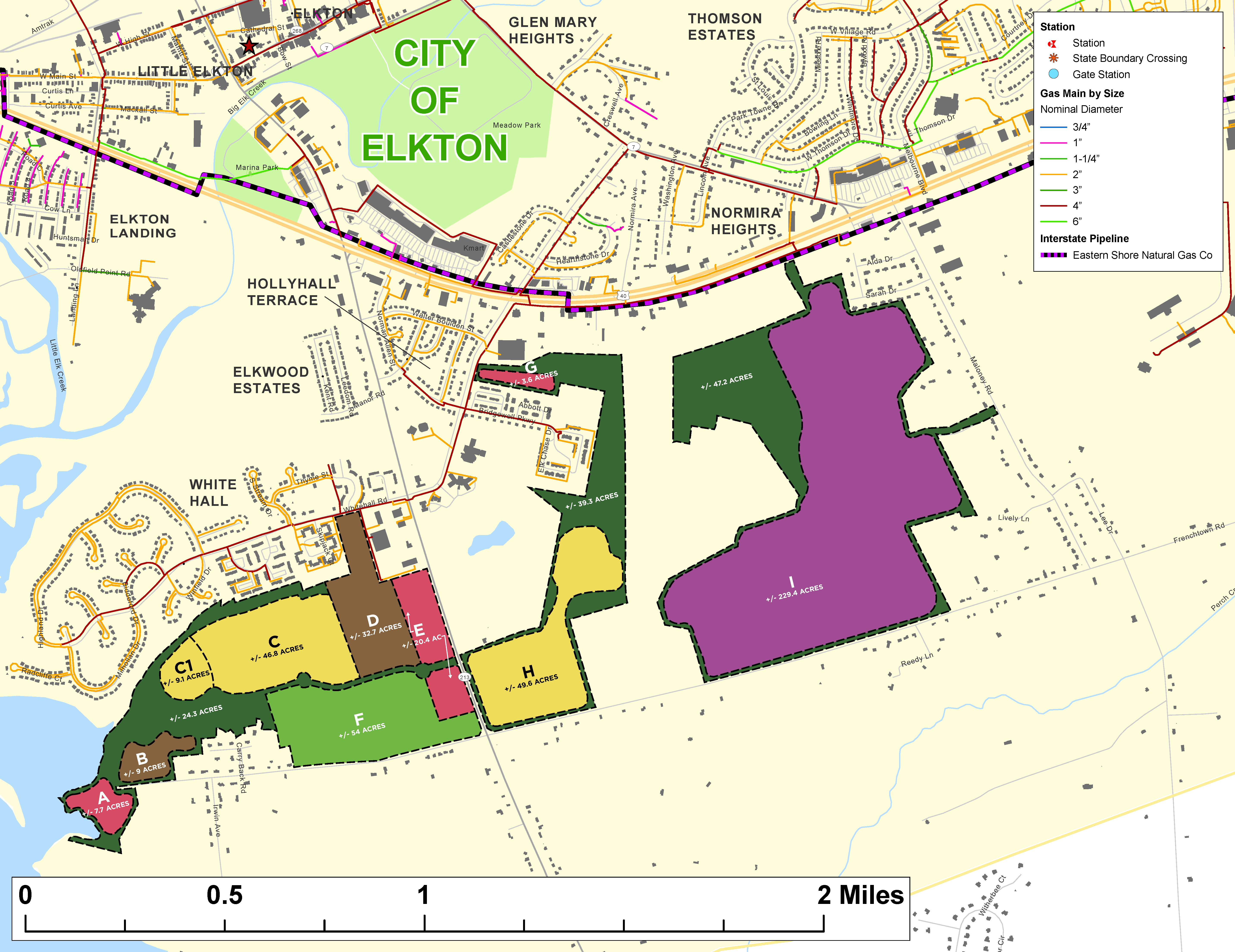

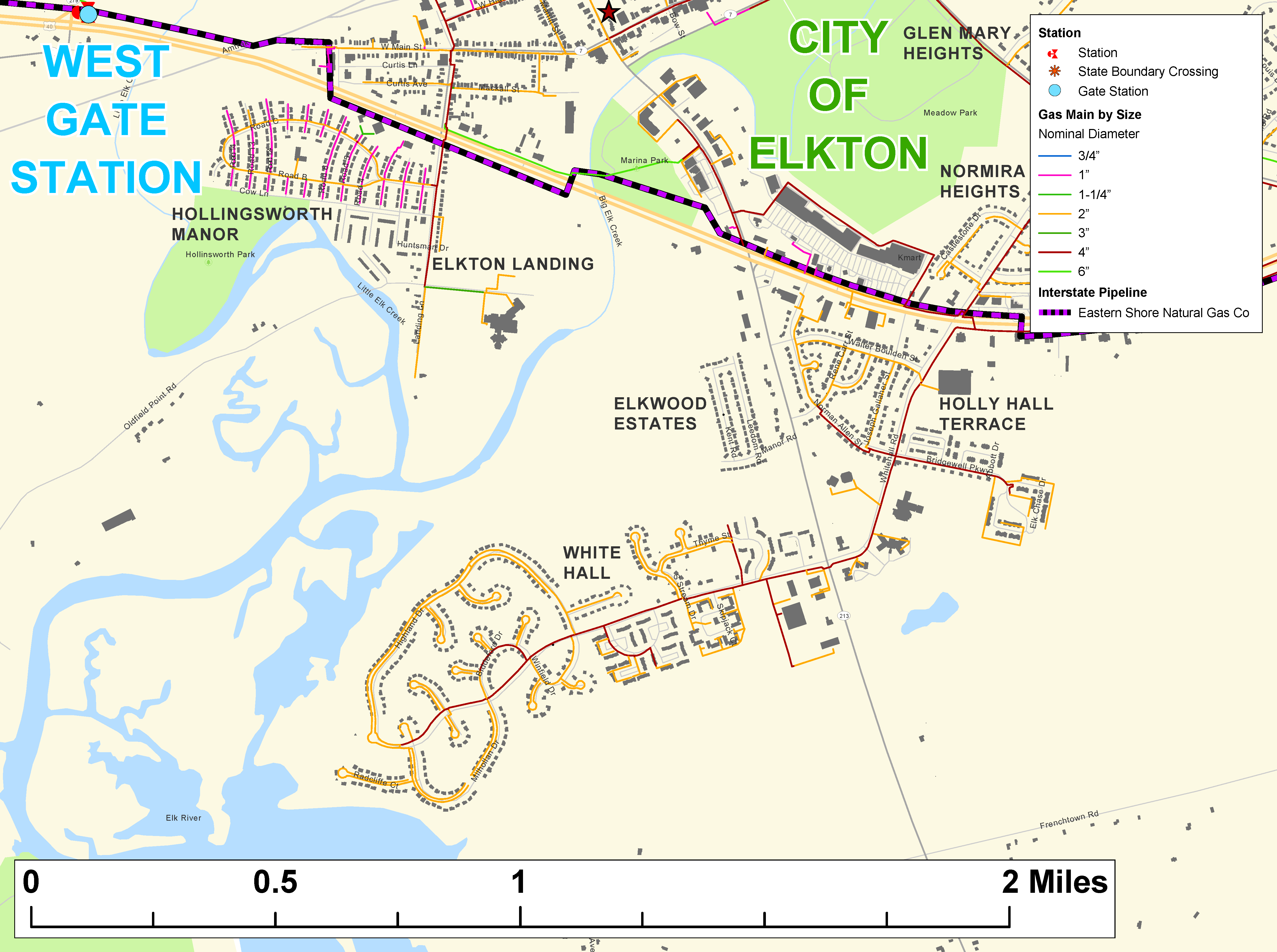
I assisted a colleague with helping their natural gas client find visibility into where they could expand their services. I gathered GIS data for the housing and input that into ArcGIS and then brought it into Illustrator where I layered the gas client’s current service territory overtop. Lastly, I added in their current expansion plans. This ended up being key in helping them move forward.